Infrastructure Planning for Land Development: How Smart Design Cuts Costs and Accelerates Projects
Introduction
Infrastructure is the invisible backbone of every successful residential development. Done right, smart infrastructure planning becomes a competitive advantage. Done wrong, it becomes a budget-crushing bottleneck that delays projects and eats profits.
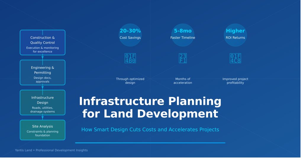
The difference between a well-planned infrastructure system and a typical approach? 20-30% cost savings, 30-40% faster timelines, and significantly fewer field changes and conflicts.
In this article, we break down the infrastructure planning strategies that experienced developers use to build efficiently, get faster approvals, and deliver better results for builders and residents.
The True Cost of Poor Infrastructure Planning
Before we dive into solutions, let’s understand the cost of getting infrastructure wrong:
Common Mistakes:
- Utility coordination failures requiring expensive relocations (+15-25% cost overruns)
- Inefficient road and drainage network design (+10-20% overruns)
- Late discovery of soil or environmental constraints (3-6 month delays)
- Lack of spare capacity in utility systems (limited future expansion)
- Inadequate stormwater planning (regulatory rejections, redesigns)
Real-World Impact: A 100-lot subdivision typically invests $800,000-$1,500,000 in infrastructure. A 25% cost overrun means $200,000-$375,000 in avoidable costs. Delays of 6 months add $150,000+ in carrying costs.
Getting infrastructure right isn’t just good practice—it’s financial necessity.
The Strategic Infrastructure Planning Framework
Successful infrastructure planning follows a systematic approach:
Phase 1: Site Analysis & Constraint Mapping
Before the first shovel hits ground, experienced developers conduct comprehensive site assessment:
Topographic Analysis
- Detailed terrain mapping identifying natural drainage
- Elevation changes affecting grading and utilities
- Low-lying areas prone to flooding or poor drainage
- Slopes suitable for different development uses
Environmental Assessment
- Existing trees and natural features to preserve
- Wetlands and protected areas requiring buffers
- Soil conditions affecting utilities and construction
- Environmental constraints limiting development
Utility Coordination
- Existing utility locations (through utility locates)
- Capacity of existing municipal systems
- Distance to utility sources (water, sewer, electric)
- Planned utility expansions affecting development
Geotechnical Evaluation
- Soil bearing capacity for roads and structures
- Groundwater conditions and seasonal fluctuations
- Soil stability and settlement characteristics
- Frost line and drainage requirements
This phase costs $3,000-$8,000 per project but identifies constraints early, preventing expensive field changes later.
Phase 2: Master Planned Infrastructure Design
With constraints mapped, comprehensive infrastructure planning creates integrated systems:
Road Network Design Efficient road networks balance several factors:
- Safety (appropriate speeds, clear sightlines)
- Cost efficiency (minimum road length achieving connectivity)
- Drainage (proper grading for flow and maintenance)
- Future expansion (extensions, connections to adjacent areas)
- Parking (appropriate ratios for different uses)
Well-designed road networks typically reduce road infrastructure 10-15% vs. inefficient designs, saving $1,000-$2,000 per lot.
Drainage System Planning Stormwater management is complex but critical:
- Detention/retention pond sizing and placement
- Drainage swale routes minimizing earthwork
- Culvert sizing and placement for efficiency
- Underground systems where appropriate
- Natural drainage preservation where possible
Municipal approvals often hinge on stormwater plans. Early coordination with city engineers and environmental agencies prevents costly redesigns.
Utility Corridor Strategy Shared utility corridors dramatically improve efficiency:
- Consolidated trenching for water, sewer, electric, telecom
- Single right-of-way rather than multiple separate trenches
- Proper spacing between utilities (code requirements)
- Future capacity built into system design
- Accessible design for maintenance
Shared corridors reduce utility costs 15-25% compared to individual installation.
Water & Sewer System Planning
- Pressure zones and gravity flow optimization
- Line sizing for peak demand plus future growth
- Lift station locations minimizing elevations
- Redundancy for reliability
- Backhaul paths for future connections
Electrical & Communications
- Underground vs. overhead cost analysis
- Fiber-ready conduit (future-proofs communities)
- Adequate capacity for modern electrical demand
- Emergency access and maintenance planning
Phase 3: Engineering & Permitting
Once master planning is complete, detailed engineering transforms concepts to constructible documents:
Design Engineering
- Utility design to code and standards
- Cross-sectional details and specifications
- Grading plans with proper swales and slopes
- Easement and right-of-way coordination
- Phasing strategy for construction sequencing
Permitting Strategy
- Early municipal coordination (saves months)
- Environmental agency coordination where needed
- Utility company approvals (water, sewer, electric)
- Drainage reviews and approvals
- Construction staging and traffic management
Proactive permitting reduces approval timelines 30-40% and identifies issues before field construction.
Phase 4: Construction & Coordination
Smart infrastructure design continues through construction:
Construction Sequencing
- Early utility installation before lot development
- Drainage systems operational before heavy rains
- Road base work on optimal schedule
- Punch-list management and quality control
Change Management
- Field conditions require flexibility
- Changes documented and approved systematically
- Cost and schedule impacts identified quickly
- Contingency reserves managed strategically
Quality Control
- Utility testing and commissioning
- Compaction verification for roads
- Drainage system testing
- Final inspections and approvals
Cost Savings Through Effective Planning
Let’s quantify infrastructure planning benefits on a typical 100-lot subdivision:
Baseline Infrastructure Budget: $1,200,000
Planning Intervention Savings:
- Optimized Road Network: Reduced length/width
- Savings: $80,000-$120,000 (8-10%)
- Shared Utility Corridors: Combined trenching
- Savings: $60,000-$100,000 (8-12%)
- Efficient Drainage Design: Optimized pond sizing
- Savings: $40,000-$80,000 (10-15%)
- Smart Phasing: Reduced carrying costs
- Savings: $50,000-$100,000 (4-8%)
- Avoided Changes: Early identification of issues
- Savings: $100,000-$200,000 (reduced change orders)
Total Potential Savings: $330,000-$600,000 (27-50% of original estimate)
For a 100-lot project, this represents $3,300-$6,000 per lot—substantial savings that directly impact profitability.
Timeline Acceleration
Beyond cost, smart planning accelerates projects:
Typical Project Without Strategic Planning:
- Site analysis & initial design: 2-3 months (after delays)
- Permitting & revisions: 4-6 months (multiple iterations)
- Engineering & final approval: 2-3 months
- Construction: 12-18 months
- Total: 20-30 months
Strategic Planning Approach:
- Site analysis & master plan: 2-3 months (upfront)
- Coordinated permitting: 2-3 months (fewer surprises)
- Engineering & approval: 1-2 months (plan clarity)
- Construction: 10-14 months (optimized sequencing)
- Total: 15-22 months
Time Savings: 5-8 months (25-33% reduction)
On a $10 million project with $50,000/month carrying costs, 6-month acceleration saves $300,000.
Specific Infrastructure Planning Examples
Example 1: Stormwater Design Excellence
Challenge: 60-acre site with complex drainage, limited municipal capacity
Strategic Approach:
- Detailed hydrologic modeling identifying peak flows
- Distributed retention (multiple small ponds) vs. single large pond
- Bioswales and pervious surfaces reducing runoff volume
- Underground detention under parking/community areas
- Green infrastructure providing dual-use amenities
Result:
- 30% reduction in detention volume
- Eliminated need for major municipal system upgrades
- Faster municipal approval
- $200,000+ cost savings
- Community amenities increasing property values
Example 2: Utility Corridor Efficiency
Challenge: 4 separate utility systems requiring 4 different trenches, major cost and coordination complexity
Strategic Approach:
- Master utility plan consolidating trenches
- Coordinated utility trenching sequence
- Proper spacing maintaining code compliance
- Shared right-of-way reducing acquisition costs
- Future capacity for expansion
Result:
- 20% reduction in trenching costs
- Single construction window vs. phased utilities
- Faster lot delivery
- Easier maintenance and future upgrades
- $150,000+ cost savings
Example 3: Road Network Optimization
Challenge: Initial design required 4.2 miles of road for 100 lots—high cost and maintenance burden
Strategic Approach:
- Efficient cul-de-sac design reducing road length
- Optimized lot orientation reducing per-lot road frontage
- Parking and access solutions minimizing road infrastructure
- Phasing allowing early density in initial phases
Result:
- Reduced to 3.1 miles of road (26% reduction)
- Lower infrastructure costs per lot
- Faster initial phase delivery
- Better traffic patterns and safety
- $250,000+ cost savings
San Antonio’s Unique Infrastructure Challenges
Developing in San Antonio and Central Texas presents specific infrastructure considerations:
Water Scarcity
- Limited water supply during droughts
- Increasing water conservation requirements
- Stormwater capture and reuse becoming standard
- Utility cost escalation
Soil Characteristics
- Limestone and caliche requiring specialized drilling
- Expansive clay soils affecting foundations
- Grading complexity in hill country terrain
- Environmental constraints (Edwards Aquifer, etc.)
Growth Pace
- Rapid growth straining municipal infrastructure
- Utility system capacity limitations
- Coordination with city expansion plans
- Infrastructure sequencing criticality
Regulatory Environment
- Environmental protection requirements (aquifers, species)
- Stormwater regulations emphasizing quality and quantity
- Historic preservation considerations
- Neighborhood compatibility and context sensitivity
Smart infrastructure planning addresses these local considerations.
When to Engage Infrastructure Expertise
Infrastructure planning expertise should engage early:
Initial Site Acquisition
- Infrastructure due diligence before purchase
- Constraint identification affecting value
- Infrastructure cost modeling
- Go/no-go decisions based on economics
Early Project Phases
- Master planning incorporating infrastructure
- Feasibility assessment
- Municipal coordination strategy
- Design approach finalization
Design Development
- Detailed infrastructure design
- Permitting coordination
- Change management
- Value engineering
Construction
- Ongoing coordination and problem-solving
- Quality assurance
- Permit compliance
- Schedule and cost management
Building Your Infrastructure Team
Successful infrastructure requires specialized expertise:
Site Civil Engineers
- Topographic and environmental assessment
- Grading and drainage design
- Road design and standards
- Stormwater management
Infrastructure Specialists
- Water and sewer system design
- Utility coordination
- GIS and modeling capabilities
- Municipal code expertise
Project Managers
- Permitting navigation
- Vendor and contractor coordination
- Schedule and cost management
- Quality control
Municipal Liaisons
- Early approval coordination
- Regulatory pathway navigation
- Relationship development
- Issue resolution
The Return on Infrastructure Excellence
Excellence in infrastructure planning delivers multiple returns:
Financial Returns
- 20-30% cost savings through optimization
- Faster completion reducing carrying costs
- Quality reducing warranty and liability issues
- Premium valuation through reputation
Timeline Returns
- 5-8 month acceleration on typical projects
- Faster lot delivery and cash flow
- Competitive advantage in market
- Reduced uncertainty and risk
Relationship Returns
- Builder confidence and loyalty
- Municipal relationships accelerating future projects
- Reputation for quality and reliability
- Partnership opportunities with top partners
Moving Forward
Infrastructure planning excellence isn’t complicated—it’s systematic. At Yantis Land, we’ve applied these principles across $1.3 billion in managed projects. Our approach combines:
- Early analysis: Comprehensive site assessment identifying constraints
- Master planning: Integrated infrastructure systems optimized for cost and function
- Municipal coordination: Proactive engagement reducing approval time
- Construction excellence: Quality execution and problem-solving
Whether your project is 30 lots or 300 lots, smart infrastructure planning delivers measurable advantages.